Monday, July 22, 2013

Emerald - Blackwater - Baralaba

Leaving Sapphire and joining the Capricorn Highway it is an easy run into Emerald, the largest town in Queensland’s central highlands. We have visited Emerald a few times in the past and we are always surprised at how much more development has taken place. This time we were on a mission. For those of you who have been following this blog you will know the frustration we have had in trying to find tyres for our van. Well, this time we were determined to give it our best shot and armed with the names and addresses of every tyre dealer in the district we began our search. We came upon a tyre service on the approach to town that was not on our list, so we stopped and made enquiries. To our complete amazement they had the tyres we needed and at a cheaper price than we had been quoted previously. The friendly proprietor said, “Bring her in” and we had the tyres fitted and on our way again in less than an hour – you beaut! Emerald has several large supermarkets and lots of other shops so we stocked up on essential supplies and headed for the free camp outside the botanic gardens for a night.

Sunset Over Bedford Weir

Next morning our journey continued eastwards on the Capricorn Hwy. to Blackwater and then 26 Km’s out to Bedford Weir. What a great place this is, with hot showers and flush loos, and you can stay for free for up to seven days. They have a small shop staffed by the helpful caretaker and twice a week the caretaker’s wife puts on a soup and damper night for a very reasonable price – just great. The only thing not available at Bedford weir is drinking water, so, if you are thinking of going there make sure you have plenty of good water with you.

The Weir Wall

Waiting for a Fish

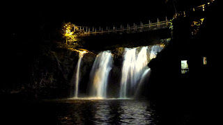
During our stay at Bedford weir we took a daytrip to Blackdown Tableland National Park. After negotiating the very steep access road you find yourself on top of a plateau many hundreds of metres above the surrounding plains. We walked to Horseshoe lookout and then 2 Km to the nearby falls and back before driving through the park to do the Rainbow Falls walk. 2 Km’s each way and mostly steep but very rewarding with a magnificent waterfall into the valley. It was great to see up-close two very distinctive plants that grow only here and nowhere else. One is a Grevillia and the other a Wattle. We really enjoyed our day out with the invigorating walks, the only thing we did not think of was the lower temperature at this higher altitude. With a reasonably strong breeze blowing from the S.E. we certainly wished we had taken a long sleeved shirt or light jacket, but never mind it just made us walk faster.
 
Horseshoe Lookout
Falls near Horseshoe Lookout

Rainbow Falls

Blackdown Grevillia

Blackdown wattle

Leaving Blackwater and travelling further east we overnighted in Duaringa before turning south to Baralaba and a great camp spot at Neville Hewitt Weir. Similar to Bedford Weir without the caretaker and the hot showers this free campground has abundant fresh drinking water on tap and is situated virtually at the end of the main street, making it quite easy to stroll into town for any thing you need. To our great delight we were able to catch up with our good, long time friends, Larry and Laurelle for a couple of nights camping. Even though we were both many miles from home at this great little camping area, you have to ask, what are the chances? of catching up like this, but we are glad we did.
Old Friends and New at Baralaba

Monday, July 8, 2013

Clermont and The Gemfields

Following the Gregory Development Road from Cape River we reached the town of Clermont by early afternoon. The town is a mix of new and old buildings and is a commercial service centre for the nearby mining industry. Our destination was Theresa Creek dam 22 Km out of town. This picturesque camping area is set along the shore near the dam wall and costs just $10 per night. There is a small shop and café where you check in and there are hot showers and flush toilets at several locations around this very large open camping area.

Theresa Creek Dam Sunset


After 4 nights at this pleasant location we headed off along, the now sealed, back road to Rubyvale in the Gemfields for a night in the neat and tidy caravan park. A walk around town lead us to some rather quirky shops, most of which were selling gemstones in various states. There are, of course, several up-market gemstone galleries where you can purchase sapphires and rubies cut and set in very attractive pieces of jewellery. We certainly did learn a lot about sapphires, not the least of which is their value. We inspected many lovely pieces valued well into the tens of thousands of dollars. Here’s a bit of trivia for you – sapphires come in almost any colour except red. The red ones are a ruby. The most common colour is blue and the most valuable is yellow. Some of the most valuable are called a ‘parti’ which is generally yellow with small evenly spaced specs of other colours, most usually blue or red.


The next day was a very long drive to the town of Sapphire, a trip of just over 6 Km’s. Of course we arrived early, which gave us most of the morning to wander through the Sunday market at the football ground. Then it was time to set up in the free camping area, would you believe, right in the middle of town. This handy location made it easy for us to walk to the shops and gem galleries, and in the evening to the local RSL. This small club has a Sunday roast for just $12 and a beer or a very full glass of wine will cost you just $3. We really did enjoy the hospitality of the friendly locals and also some fellow campers we sat with for the delicious meal.

Tuesday, July 2, 2013

Heading Inland

Having now had disappointment three times with getting tyres for our van the decision was made to venture away from the coast. The school holidays had begun and understandably the coastal areas are quite popular and busy. From Townsville we travelled west over Herveys Range to intersect the Gregory Development Road where we turned south for our next stop at Fletcher Creek approximately 42 Km north of Charters Towers. This is a large and open camping area stretching along the creek on both sides of the road with a third area on the other side of the creek where the amenities, with showers and toilets, are located. Fletcher Creek was very popular at the time of our visit, presumably because of the school holidays, but it was never what you would call crowded. During our stay of two nights we visited the adjacent Dalrymple National Park along the banks of the Burdekin River. On the morning of our departure I decided to have a walk around the entire camping area just to count how many sets of campers there were – would you believe the total was 99? Camps ranged from small hatchbacks with tiny tents, right up to the largest motorhome but, the majority, of course were caravans of every make, model and size. It seems many people have caught the free camping bug!
A Misty Morning - Fletcher Creek


It's not crowded

Enjoying the Campfire at Fletcher Creek


Around 22 Km east of Charters Towers is Macrossan Park, another great free camping area. Situated on the upper banks of the Burdekin River the camping area lies between the road and rail bridges across the river, however from the centre of the area it is about 1 Km to either. The two rail bridges (one old, one new) dominate the scenery, with the old bridge (disused since the 1960’s) very photogenic, particularly in the late afternoon light. Macrossan Park was nowhere near as popular with between 30 and 40 campers on each of the two nights we spent there. Back into Charters Towers to stock up on some provisions, and yet another (futile) attempt to locate tyres for the van, before heading southward on the Gregory Development Road for an overnight stop at the small Cape River rest area.
Camped at Macrossan Park
New Rail Bridge on left - Old on right
Campers on the Burdekin


The charm of the old bridge


Birdlife on the Burdekin

Wednesday, June 26, 2013

Townsville Area 8/06 to 24/06

The ‘Bushy’ Parker reserve at Rollingstone was extremely popular with locals and travellers alike over the June long weekend. However it is quite a large area and never seemed to be overcrowded. The Townsville region would have to have the best collection of free camping areas anywhere. Found mostly to the north of the city all are less than 50Km from the centre of town. They range from small beachside sites like Saunders Beach and Balgal Beach, to much larger ones at Bluewater, Toomulla Beach and Rollingstone. All have clean flush toilets and access to good clean drinking water and, most have an outside cold shower. Good on you Townsville and Thuringowa Council !! Understandably, they are all very popular and were quite full each night.

Waterfront Parklands in the old part of Townsville

We took good advantage of all of the above areas as we spent more than two weeks in the area waiting for tyres for our caravan. Even being the large regional city that Townsville is, none of the tyre dealers we visited (about 7 or 8) had suitable tyres in stock. A few of the dealers were able to order them in for us, and after agreeing on a price we placed an order. The appointment was made to have them fitted but when we arrived we found the wrong tyres had been sent from the warehouse. So after much more negotiation we agreed to wait another eight days while they were ordered from ‘down south’ (Brisbane or Sydney ?) only to find ,yet again, that the wrong ones had been sent. What to do next? With the tyres still just legal we decided to continue our journey in the hope of finding a set along the way.

Along 'The Strand'


In spite of all this we very much enjoyed our stay in the area and we think Townsville is quite a nice place to visit. We visited the city several times to stroll along ‘The Strand’ waterfront area and also visited the botanic gardens as well as the Cockatoo Creek area of the Bowling Green Bay N.P. to the southwest.
Botanic Gardens

Part of the Palmetum

Tropical Rainforest Walk


Sunday, June 9, 2013

Tully - Ingham - Rollingstone 7/06

It was with great reluctance that we left Paronella Park and headed back towards the highway. Travelling this busy road we were soon passing Tully and then a detour to Hull Heads just to check it out. Back on the highway again it was an easy trip to the Bilyana rest area for a late-ish lunch stop. Upon investigation we found a really great spot tucked in behind the trees so the decision was made to stay overnight.


Refreshed after a peaceful night’s sleep it was back on the road for the short trip through Kennedy and on to Cardwell where we took time out to view the memorial to the battle of the Coral Sea. We suspected that the roadwork we had encountered on the trip north would still be happening, and we were quite right. There were extensive hold-ups from Cardwell town, over the Cardwell range and several other places before reaching Ingham. Our lunch break in Ingham was extended to take in the boardwalk over the beautiful parkland and a stroll through the Tyto wetlands, and then some shopping to top up the provisions. The long weekend starts tomorrow and we didn’t want to run short of supplies. From Ingham it is only around 50Km to the Bushy Parker Reserve at Rollingstone where we were to stay for the weekend.

Saturday, June 8, 2013

Paronella Park 6-7/6

After a leisurely pack-up at Rifle Creek (Mt. Molloy) we travelled down the range on a steep winding highway through lush tropical rainforest to reach the coast just south of Mossman. Then south along the very scenic Captain Cook Highway to reach Cairns in time for some lunch and shopping. From Cairns we followed the road south to Babinda where we took advantage of a great free camping area at ‘The Boulders’ just west of the town. The next morning was spent wandering around the quaint shops of this charming little Queensland sugar town (although we noticed the mill was no longer in operation and was being demolished) before following the highway south to Innisfail then the old highway and back roads to Mena Creek to visit Paronella Park


Spanish migrant Jose’ Paronella had a dream of building a castle, a dream which he fulfilled. He chose 5 hectares (13 acres) of rainforest beside Mena Creek Falls where he designed and built his castle with picnic areas, tennis courts, bridges, a tunnel and magnificent gardens with over 7,500 tropical plants. Commenced in 1930 it opened to the public in 1935. Jose’ passed away in 1948 and his wife in1967 and from then the castle and it’s surrounds were gradually overgrown by the rainforest. Rediscovered by the current owners Mark & Judy Evans in 1993 the park is now gradually being restored, although there is still much to do. It is very pleasing to see that there has been no attempt to remove any of the charming ‘aged patina’ that gives this place such a magnificent character.


 Admission to the park includes guided tours, both day and night, and a night in the park’s own Caravan Park. Even though it rained during most of our time there we still made the most of the tours and really are glad we went a little out of our way to visit.


Thursday, June 6, 2013

Cape York 24/4 to 4/6

An early pack up and refuel saw us on the road from Cooktown shortly after nine. Our first priority was to return along the Mulligan Hwy. to Lakeland to put the van in storage while we took off on our trip up the cape. With securing the van taken care of it was time for morning tea before our departure on the road to Laura. This road is now newly sealed and it seemed like in no time we were at the ‘Split Rock’ aboriginal art site. With a short climb up the escarpment we were marvelling at this unique and ancient, well preserved Quinkan style art. 
Split Rock Art Site

Then on to Laura for a quick look around and a loo break at the shady park. From here on we would not see too much sealed road and although, in general the road conditions were quite good, the dust was very apparent which meant keeping quite some distance between vehicles – thank goodness for C.B. radios so we could keep in contact each other. Lunch was taken at Hann River and then on to our first overnight camp at Morehead River just south of Musgrave telegraph station. Here we put up our tent for the first time in ages and even in the heat we had our camp completely set up in little more than 30 minutes, leaving plenty of time to gather firewood before sunset, Brian even managed some fishing in the river. He didn’t manage to catch anything substantial but did manage to snag his lure in an overhanging tree, which meant an interesting retrieval process was undertaken. After dinner we sat round the campfire for while before retiring for a peaceful night’s sleep under canvas.

Morehead River Camp

I am afraid to keep describing our trip up the cape in detail would take too long and be much too boring so let me summarise and then let the pictures do the talking. In total it took us 12 days to go up and back. Day two saw stops at Musgrave, Coen and Archer River before an overnight in Weipa. Day three we travelled via Batavia Downs with stops at Moreton telegraph station and Bramwell Junction before the start of the infamous ‘Old Telegraph Track’ or the OTL as it is sometimes called. This track is totally un-maintained and has become very rough and overgrown. We made it through the first creek crossing without drama but unfortunately found the next, Palm Creek, quite a different story. After much sizing up I decided to give it a try but unfortunately was not able to climb out the other side and needed Brian’s assistance to retreat doing a fair bit of damage to my vehicle in the process. This took a lot of time and it was soon late afternoon so we decided to make camp right beside the track. Never mind, with a campfire BBQ dinner and a few drinks around the fire the dramas of the day were soon forgotten.

Palm Creek

Al prepares dinner

While Sue watches the fire


Day four saw us retreat back to Bramwell Junction to travel up the southern bypass road to reach one of the highlights of any trip up the cape, Fruit Bat Falls and then on to Elliot Falls for our overnight camp. 
Bramwell Junction

Fruit Bat Falls

Enjoying the waters below the falls
Elliot Falls
Twin Falls
Sue & Petra get a massage at Twin Falls

Day five we travelled on to Vrilya Point on the western coast of the cape for two idyllic nights camped on the beach just metres from the water, but not before a few more creek crossings on the OTL
Crossing Canal Creek

On the way to Vrilya Point

 You could never tire of the beachcombing and watching the sunset into the waters of the gulf each evening.
Our camp at Vrilya Point


Nice catch Brian !

Wreck on beach at Vrilya Point

Toasting the sunset over the gulf

On day seven we crossed the Jardine River ($129 for a 40 metre ferry ride) and then on to Bamaga and finally Seisia for three nights at the Loyalty Beach campground. During this time we drove and then walked to the very tip of the Australian continent where we toasted the occasion with a nice chilled bottle of wine before exploring the ruins of somerset and inspecting some of the plane wrecks of WWII.
On the way to the Tip


Clearing the track

We made it to the tip


Time to celebrate

Checking our bearings

 Then a day trip to Thursday Island and lunch in the most northerly pub in Australia (with a couple of nice cool ales – of course) The return journey was made without any detours (except to Elliot and Twin falls for a lunch break and a swim) and so only took three days. Overnight camps were taken at Wenlock River and Morehead River before collecting the van from Lakeland and then on to Mt. Molloy and another fabulous burger from the café and then overnight once more at Rifle Creek rest area just out of town. Early the next morning we farewelled Petra and Brian as they had pressing commitments further south. It was a little sad to say goodbye as we had really enjoyed their company on our adventure to the tip of Australia.